GIS Solutions
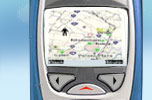
Sutra has been developing GIS (Geographic Information System) solutions for Navigation, Tracking and Disaster Management. We leverage our expertise for developing solutions that are compatible with PDAs and Mobile Devices.
Main sub offerings are as follows:
![]() Navigation System
Navigation System
We provide solutions for devices like Cellular Phones and PDAs to help navigate services that are more cost effective than GPS.![]()
![]()
![]()
![]() Disaster Simulation
Disaster Simulation
Simulating disaster situations for providing “what-if” scenarios for disaster contingency planning and better decision making at the time of actual disaster.
![]() File Translation
File Translation
File Translators help to translate different GIS data formats like KIWI, DiMSIS, DXF, SIMA etc.


